One day, swim in the Guaíba again.
I'm building a small, low-cost boat, driven from the shore with a phone, that samples the water at the right spot and records where, when and what the sensors read. To find out, point by point, where the water is good and where it is not.
The lake
Lake Guaíba is the heart of Porto Alegre. In Ipanema, the shore has a promenade, famous sunsets and lots of people looking at the water.
But along much of the urban shore, swimming is often not advised, and people rarely know why, or where the water is worse.
img/orla-ipanema.jpg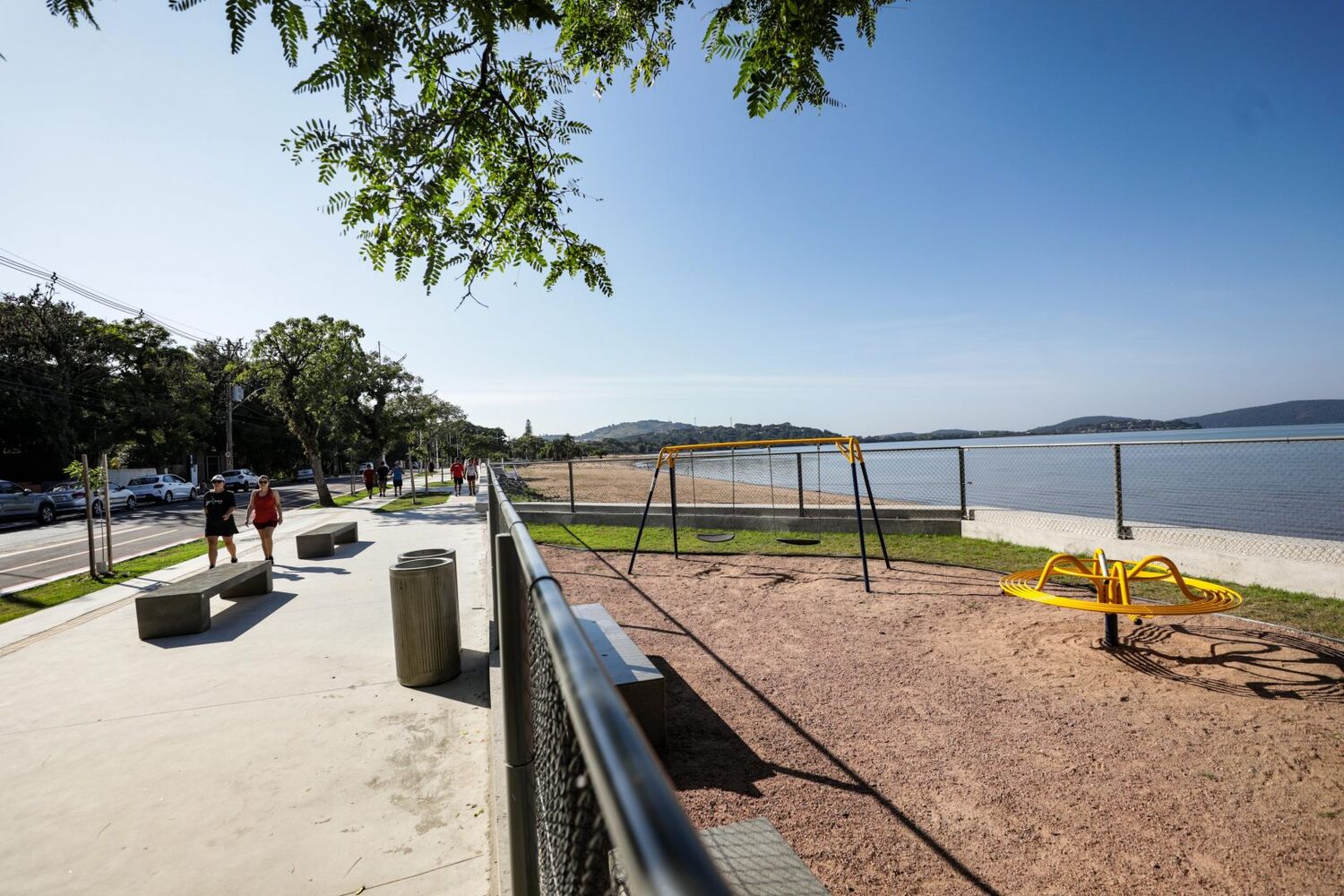
Official monitoring covers fixed points. Between them, and right after storms, little is known.
Rainwater outlets that may carry sewage are scattered along the shore, and what comes out of them changes with every storm. Sampling from a motorboat with a crew is expensive, so it happens rarely and covers few points.
The idea: a boat made of pipes
A boat about one meter long, made of PVC pipes, that comes apart and fits in a motorcycle box and a backpack. No expensive parts: bilge-pump motors, two small ESP32 boards and simple sensors.
- Sensors temperature, conductivity and turbidity, dipped in the water.
- Hull 4 PVC pipe floats, 40 cm each, that come apart.
- Motors 2 adapted bilge pumps with propellers.
- Waterproof box two ESP32 boards (motor and science) and the battery.
- GPS records where each bottle was collected.
- Pumps and bottles each bottle has its own pump and fills at the chosen spot.
- Safety tether during tests, the boat is always tied to the shore.
How it works
Plan on the map
Sampling points are marked on a map of the lake, near rainwater outlets and at reference points.
Go and measure
The boat goes to the point, driven with a phone. When the sensor readings change near an outlet, we can follow the change to where it is strongest.
Sample and record
Small pumps fill the bottles at the chosen spot. Each bottle gets a record and goes on to analysis.
img/demo-mapa.png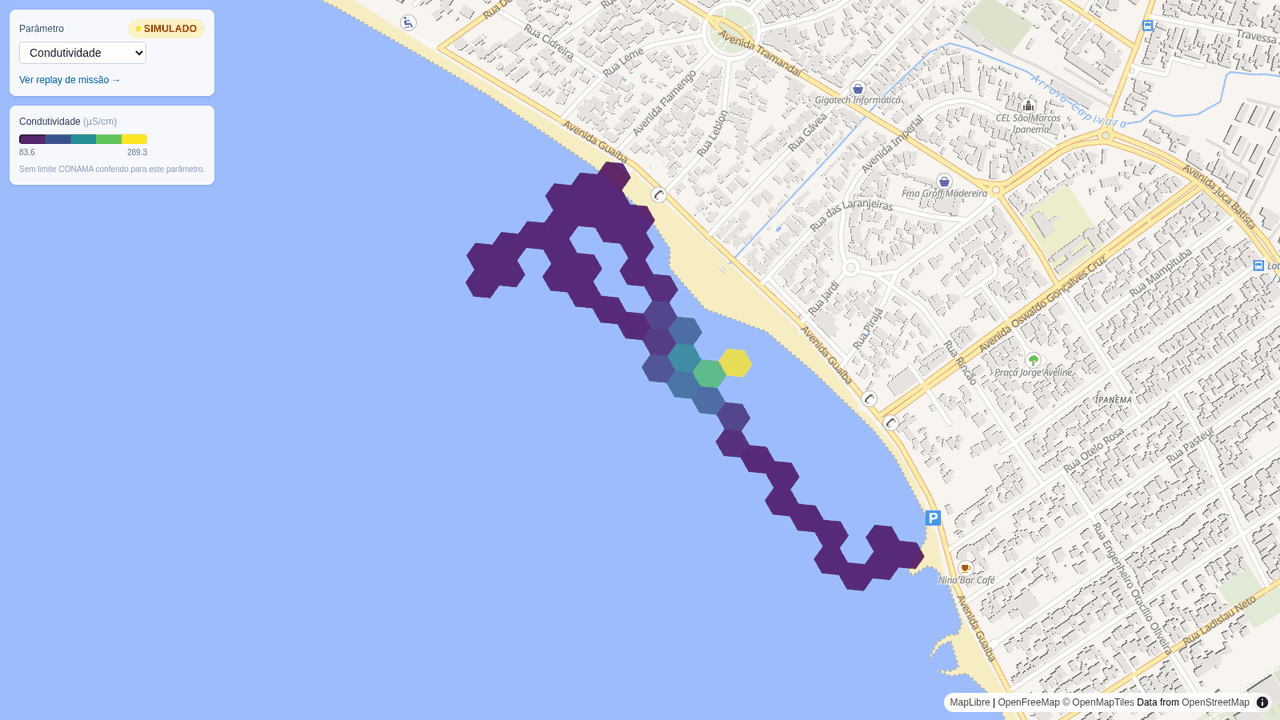
img/demo-controle.png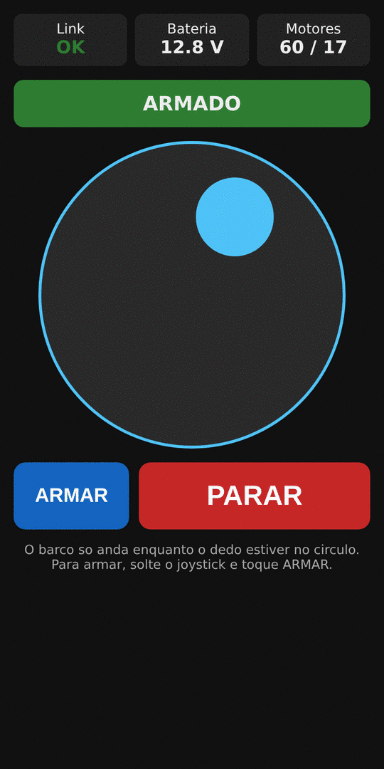
img/demo-coletor.png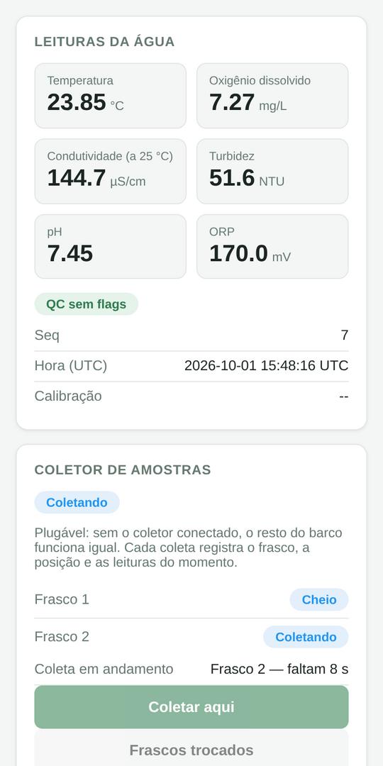
The software is already written and tested in a simulator. Interactive demo with simulated data: coming soon.
Why the boat takes samples
Before building, I looked at what studies say about finding sewage in water. Each finding became a project decision.
-
the right spot
Simple sensors lead to the plume
Temperature, conductivity and turbidity tend to show concentrated plumes near rainwater outlets in dry weather. That is what the boat needs to reach the right place to sample.
-
R² 0.85
The bottle does the fine work
Fluorescence is the sewage signal with the most evidence in open water. Measured on the filtered sample, on a bench, it tracked fecal bacteria much better (R² 0.85) than a probe in murky water (up to 0.5).
-
no costly probe
Cheap where possible, precise where it matters
Instead of an imported probe costing $1,600 to $7,500, which still struggles in murky water like the Guaíba, the boat carries cheap sensors and brings the sample to those who measure it precisely.
And it opens new research: low-cost fluorescence sensors already work in drinking water, but they have not yet been tested on a boat in a murky lake. That is one of the goals of Stage 3.
Sources: Tijuana River estuary, study 1 and study 2; Khamis et al., 2015; illicit discharge manual (NEIWPCC/EPA).
One bottle, one record
A bottle of water without a record is worth little. Every sample the boat collects comes with a record: the exact spot, the time, what the sensors read and the context, such as rain in the hours before.
It is screening, not certifying: the boat points to where sampling is worth it and delivers well-recorded samples. Lab analysis is what confirms.
BOTTLE 02
- Date
- 2026-09-14 16:31
- Spot
- -30.13846, -51.23072
- Temp.
- 22.4 °C
- Cond.
- 310 µS/cm
- Turb.
- 61 NTU
- Context
- 6 h after rain
- Note
- plume peak
- Goes to
- lab
For the people of the shore
The shore belongs to the people who live, row, sail and walk there. What the boat finds goes back to them.
- Open dataData and maps will be published openly, so anyone can look up every point and every bottle.
- Findings go to those who can actWhen sampling points to a problem, it goes to the responsible agencies through official channels, with the record of each bottle. The open map shows whether the water got better.
- Open conversationShare the results with residents and nautical clubs, and listen to what they see in the water.
- Safety firstTests are tethered, close to the shore and supervised, within the rules of the maritime authority.
Project stages
Like a game: each stage unlocks the next. And each one starts only when the previous one has answered its question.
-
Stage 0done
Software and first conversations
Phone control, sensors, the sampler and the map, tested in a simulator. Asked the city and the river authority about the rules for operating on the lake.
- Unlocks
- Everything that comes next already has its software.
- Estimated cost
- $0
-
Stage 1next
First boat on the water
A hand test from a pier, the minimal boat (always tethered and supervised) and 10 to 20 samples confirmed by a lab.
- Unlocks
- Knowing whether the boat points to the right places, and publishing the first open map of the shore.
- Estimated cost
- about $1,000
-
Stage 2locked
Autonomous boat
The boat visits the points on its own and samples right after rain, when it matters most.
- Unlocks
- Regular sampling along the shore, with fewer people and lower cost.
- Estimated cost
- about $5,000
-
Stage 3locked
Litter and new research
A camera to map floating litter, a collector guided by the map, a low-cost fluorescence sensor built for murky water and, maybe, sonar to measure silting near clubs and marinas.
- Unlocks
- Caring for the water as a whole: sewage, what floats and the lake bed.
- Estimated cost
- about $7,500
-
One dayfinal goal
Swim in the Guaíba
Knowing where the water is good.
Estimates based on Brazilian stores and labs, converted from reais. No salaries.
Who is behind it
I'm Leonardo Cruz, a software developer with 5 years of full-stack experience, living in the south zone of Porto Alegre. I've always loved beaches, and since I was a kid I've looked at Ipanema beach with the same wish: to be able to go into the water.
This project brings the two together. I run it independently, with what I know how to do: firmware, web apps and maps. I'm not a water scientist, so I'm looking for people who are, to guide the sampling and the analysis.
Let's talk
I'm looking for researchers, labs and nautical clubs to do this together, and for support with materials for the next stages.
leonardo.m.cruz [at] hotmail.com